Understanding Surveys
The definitions and examples below are provided to gain additional understanding about standard concepts and terms associated with surveys. If you have questions about a survey Chastain & Associates has provided for you, please contact us.
Bearings
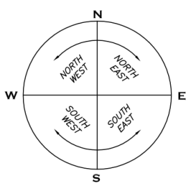
Bearings are measured as the angle from due north and due south. They are stated as which quadrant they are in, as identified by the first and last letter of each bearing.
Survey Distances
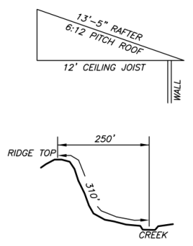
Survey distances are expressed in horizontal feet. Horizontal distances are the same as “map” or “flat” distances as would be viewed from a high elevation. The slope of the surface of the ground is taken into account when performing surveying measurements. Steep slopes and features such as streams can result in a slope distance, or distance along the surface, that is considerably longer than the horizontal distance, as illustrated above.
High Precision Angular Measurements
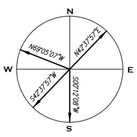
High precision angular measurements are stated in degrees, minutes, and seconds. There are 360 degrees in a full circle, 60 minutes in a degree, and 60 seconds in a minute. This is often but incorrectly confused with GPS coordinates.
Acreage
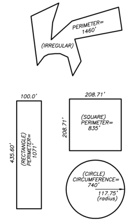
Acreage is a measurement of surface area. It is not fixed as a square or other shape. Any shape has area, even if challenging to calculate. Each of the shapes above contain one acre of surface area. As can be seen, the shape and distance around the outside of the shape can vary greatly yet still contain the same surface area.
GPS Coordinate
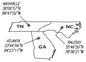
GPS coordinate, also known as geodetic coordinates or “lat/long”, consists of two components. The first is the latitude. This is the angular measure from the center of the earth as referenced to the equator as being at zero degrees and the north pole as ninety degrees. The closer to the equator a location is, the lower the value of the latitude. The second component is longitude, which is the angular measure along the circumference of the earth in a clockwise direction as referenced as Greenwich, England at zero degrees. Latitude and longitude are expressed in degrees (often degrees, minutes, and seconds) and followed by a letter that designates as being north of the equator and west of Greenwich, England.